NOAA’s New Pacific Satellite Has Sent Back Its First Glorious Images of Alaska and Hawaii

- 2018-11-16
- Gizmodo
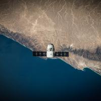
When GOES-17 launched, meteorologists’ hearts skipped a beat. The satellite offered a chance to view all of the U.S. in exceedingly high resolution, and with it, the weather forecasting possibilities were endless.
The National Oceanic and Atmospheric Administration launched the satellite in March, but it finally got it positioned in its permanent location late last month. The agency has now released the first satellite images from that new spot.
In its testing location, it was able to see the western U.S. But its final resting spot 22,240 miles above the Earth’s surface centered over 137.2 degrees West and the equator opens up a whole new world of possibilities. The new images include incredibly high-resolution satellite imagery of Hawaii, Alaska, and a vast swath of the Pacific Ocean.